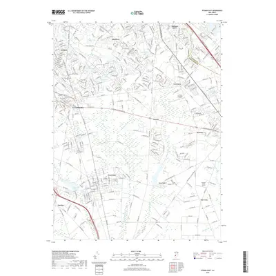
2019 Map of Pitman East
USGS Topo · Published 2019About this map
The suburban and wooded reaches of Gloucester County and Camden County are captured here as they appeared in 2019, showing a landscape defined by significant university and aviation hubs. At the western edge, the expansive grounds of Rowan University dominate the Glassboro area, while the northern residential expansion of Pitman and Whitman Square contrasts with the dense networks of creeks and runs to the south. Scotland Run and Little Ease Run drain the southern portion of the sheet, winding past historical markers such as Fries Mill and Clayton. Local genealogy is well-documented through sites like Cedar Green Cem, Manahath Cem, and the Land of Canaan Cem. Aviation history and current operations are anchored by both the Cross Keys Airport and Southern Cross Airport, reflecting the region's role as a transition point between the Philadelphia suburbs and the Atlantic coastal corridor via the Atlantic City Expy.
Find a feature on this map
46 named features on this map. Tap any name to fly to it.
Don’t see what you’re looking for? This feature index may not catch every label — zoom into the map to look around manually.
Map Details
Editions of this 2019 Pitman East Map
This is the sole edition of this map. No revisions or reprints were ever made.
Other maps of this area

1888 · Mount Holly
USGS Topo · 1:62,500

1890 · Hammonton
USGS Topo · 1:62,500

1890 · Glassboro
USGS Topo · 1:62,500

1891 · Philadelphia
USGS Topo · 1:62,500

1894 · Hammonton
USGS Topo · 1:62,500

1894 · Mount Holly
USGS Topo · 1:62,500

1894 · Philadelphia
USGS Topo · 1:62,500

1896 · Philadelphia
USGS Topo · 1:62,500

1898 · Glassboro
USGS Topo · 1:62,500

1898 · Philadelphia
USGS Topo · 1:62,500