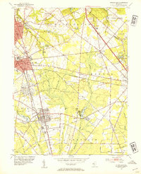
1953 Map of Pitman East
USGS Topo · Published 1954About this map
The educational and agricultural landscape of Gloucester County emerges in this early 1950s survey, dominated by the campus of the State Teachers College in Glassboro. The region serves as a vital transportation corridor, where the Pennsylvania-Reading Seashore Lines and the Black Horse Pike facilitate movement between the growing boroughs and the surrounding farmland.
Find a feature on this map
63 named features on this map. Tap any name to fly to it.
Don’t see what you’re looking for? This feature index may not catch every label — zoom into the map to look around manually.
Map Details
Editions of this 1953 Pitman East Map
2 editions found
Other maps of this area

1888 · Mount Holly
USGS Topo · 1:62,500

1890 · Hammonton
USGS Topo · 1:62,500

1890 · Glassboro
USGS Topo · 1:62,500

1891 · Philadelphia
USGS Topo · 1:62,500

1894 · Hammonton
USGS Topo · 1:62,500

1894 · Mount Holly
USGS Topo · 1:62,500

1894 · Philadelphia
USGS Topo · 1:62,500

1896 · Philadelphia
USGS Topo · 1:62,500

1898 · Glassboro
USGS Topo · 1:62,500

1898 · Philadelphia
USGS Topo · 1:62,500