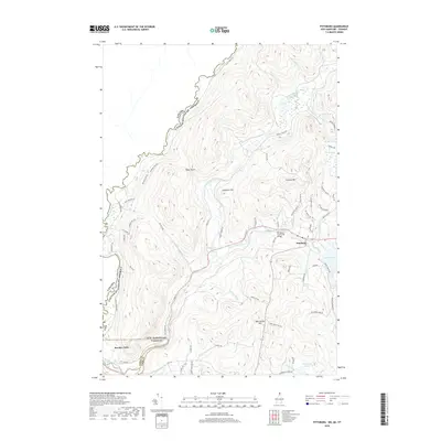
2018 Map of Pittsburg
USGS Topo · Published 2018About this map
Halls Stream and the Connecticut River delineate the international and state boundaries in this northern frontier region where New Hampshire, Vermont, and Canada meet. The landscape is defined by the convergence of major waterways and high-elevation terrain, including Tabor Notch and Shatney Mtn. The settlement of Pittsburg serves as a local hub near the shores of Lake Francis, connected to the surrounding countryside by a network of timber and access roads like Cheese Factory Rd and Indian Stream Rd. To the southwest, Beecher Falls sits at a critical junction of the river and the Vermont border. This 2018 survey detail provides an essential record of modern land use and topography in the Great North Woods, capturing the relationship between isolated mountain ponds like Moose Pond and the growing recreational and residential infrastructure centered around the Pittsburg-Clarksville Bridge.
Find a feature on this map
70 named features on this map. Tap any name to fly to it.
Don’t see what you’re looking for? This feature index may not catch every label — zoom into the map to look around manually.
Map Details
Editions of this 2018 Pittsburg Map
This is the sole edition of this map. No revisions or reprints were ever made.
Other maps of this area

1925 · Indian Stream
USGS Topo · 1:48,000

1926 · Indian Stream
USGS Topo · 1:62,500

1927 · Indian Stream
USGS Topo · 1:62,500

1929 · Averill
USGS Topo · 1:62,500

1930 · Dixville
USGS Topo · 1:62,500

1933 · Dixville
USGS Topo · 1:62,500

1934 · Dixville
USGS Topo · 1:62,500

1949 · Jackman
USGS Topo · 1:250,000

1950 · Lewiston
USGS Topo · 1:250,000

1953 · Averill
USGS Topo · 1:62,500