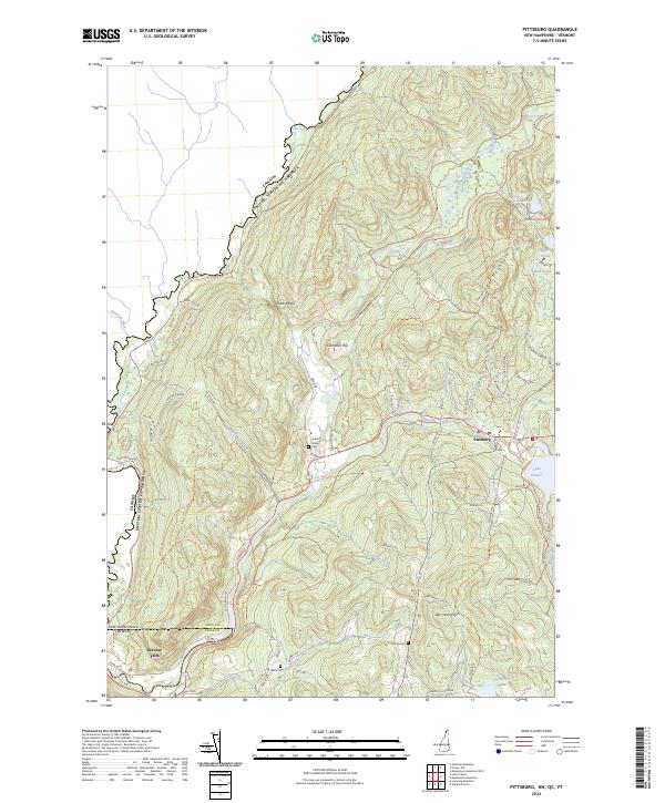
2024 Map of Pittsburg
USGS Topo · Published 2024About this map
Halls Stream and Indian Stream carve through this international borderland, defining the remote landscape of New Hampshire’s northernmost reaches. The village of Pittsburg sits at the edge of Lake Francis, where local roads like Cheese Factory Rd and Back Lake Rd suggest a history rooted in small-scale agriculture and timber. The geography is characterized by sharp relief, including Shatney Mountain and the prominent Tabor Notch.
Find a feature on this map
77 named features on this map. Tap any name to fly to it.
Don’t see what you’re looking for? This feature index may not catch every label — zoom into the map to look around manually.
Map Details
Editions of this 2024 Pittsburg Map
This is the sole edition of this map. No revisions or reprints were ever made.
Other maps of this area

1925 · Indian Stream
USGS Topo · 1:48,000

1926 · Indian Stream
USGS Topo · 1:62,500

1927 · Indian Stream
USGS Topo · 1:62,500

1929 · Averill
USGS Topo · 1:62,500

1930 · Dixville
USGS Topo · 1:62,500

1933 · Dixville
USGS Topo · 1:62,500

1934 · Dixville
USGS Topo · 1:62,500

1949 · Jackman
USGS Topo · 1:250,000

1950 · Lewiston
USGS Topo · 1:250,000

1953 · Averill
USGS Topo · 1:62,500