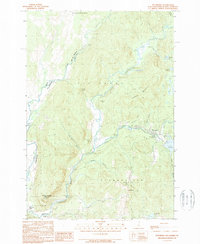
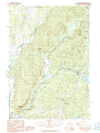
1989 Map of Pittsburg
USGS Topo · Published 1989About this map
The Connecticut River serves as the focal point of this northern New Hampshire landscape, where the international boundary between the Canada United States border and the state lines of New Hampshire and Vermont converge. The settlement of Pittsburg sits near the headwaters, just north of the expansive Lake Francis, which is contained by a Concrete Dam and Earth Dam. The map documents a terrain defined by narrow notches and significant hills, such as Tabor Notch and Ben Young Hill, alongside the winding paths of Halls Stream and Indian Stream. Local infrastructure is marked by scattered Gravel Pits and the Clarksville Pond Campground, reflecting a region tied to both resource extraction and seasonal recreation. For genealogists and local historians, the map details small settlements like Clarksville and Beecher Falls, providing a precise record of the road network and water power features at the end of the 1980s.
Find a feature on this map
44 named features on this map. Tap any name to fly to it.
Don’t see what you’re looking for? This feature index may not catch every label — zoom into the map to look around manually.
Map Details
Editions of this 1989 Pittsburg Map
3 editions found

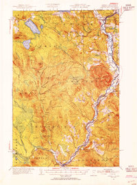
Other maps of this area

1925 · Indian Stream
USGS Topo · 1:48,000

1926 · Indian Stream
USGS Topo · 1:62,500

1927 · Indian Stream
USGS Topo · 1:62,500

1929 · Averill
USGS Topo · 1:62,500

1930 · Dixville
USGS Topo · 1:62,500

1933 · Dixville
USGS Topo · 1:62,500

1934 · Dixville
USGS Topo · 1:62,500

1949 · Jackman
USGS Topo · 1:250,000

1950 · Lewiston
USGS Topo · 1:250,000
1953 · Averill
USGS Topo · 1:62,500