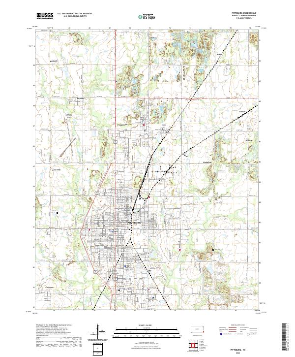
2022 Map of Pittsburg
USGS Topo · Published 2022About this map
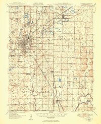
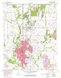
Pittsburg and the surrounding Crawford County coal country are defined by a complex network of small settlements and industrial drainage. The southern extent is anchored by Pittsburg State University and the Crawford County Judicial Center, while the outskirts are marked by a significant number of memorial sites including Highland Park Cem, Mount Olive Cem, and Zion Cem. The landscape is etched by the branches of Cow Cr, with First Cow Cr and Second Cow Cr carving through the terrain near the Atkinson Municipal Airport.
Find a feature on this map
60 named features on this map. Tap any name to fly to it.
Don’t see what you’re looking for? This feature index may not catch every label — zoom into the map to look around manually.
Map Details
Editions of this 2022 Pittsburg Map
This is the sole edition of this map. No revisions or reprints were ever made.
Historical Maps of Yale Through Time
5 maps found