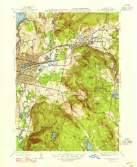
1947 Map of Pittsfield East
USGS Topo · Published 1947About this map
The East Branch Housatonic River winds through a landscape of heavy industry and natural landmarks in the years following World War II. The Boston and Albany RR serves as a critical corridor through Pittsfield and Dalton, linking the urban manufacturing centers to the surrounding highlands. This era showcases a complex water management system essential for both municipal needs and industrial power, evidenced by numerous catchments like Ashley Reservoir, Farnham Reservoir, and Sackett Reservoir dotting the slopes of Washington Mountain. High-altitude recreation and conservation are already well-established, with the Appalachian Trail traversing the ridgelines near Warner Hill and the scenic Wahconah Falls located northeast of the Dalton settlement. Local neighborhoods such as Lakeview Terrace near Pontoosuc Lake show the mid-century residential footprint of the Berkshire region.
Find a feature on this map
46 named features on this map. Tap any name to fly to it.
Don’t see what you’re looking for? This feature index may not catch every label — zoom into the map to look around manually.
Map Details
Editions of this 1947 Pittsfield East Map
3 editions found
Other maps of this area

1886 · Greylock
USGS Topo · 1:62,500

1886 · Becket
USGS Topo · 1:62,500

1888 · Becket
USGS Topo · 1:62,500

1888 · Berlin
USGS Topo · 1:62,500

1888 · Pittsfield
USGS Topo · 1:62,500

1890 · Pittsfield
USGS Topo · 1:62,500

1890 · Berlin
USGS Topo · 1:62,500

1891 · Greylock
USGS Topo · 1:62,500

1893 · Becket
USGS Topo · 1:62,500

1893 · Greylock
USGS Topo · 1:62,500