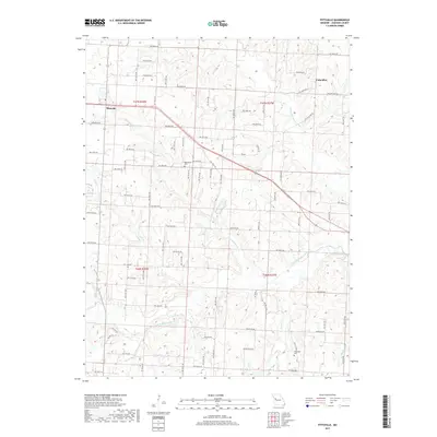
2017 Map of Pittsville
USGS Topo · Published 2017About this map
The confluence of numerous small waterways defines this rural landscape in western Missouri. Small settlements like Pittsville and Columbus sit amidst a network of section-line roads and winding creeks. The hydrography is particularly complex here, with the N Fork Blackwater River and S Fork Blackwater River converging into the main Blackwater River. These drainages are supported by smaller tributaries including Little Blackwater Cr, Pin Oak Cr, and Butcher Br.
Find a feature on this map
51 named features on this map. Tap any name to fly to it.
Don’t see what you’re looking for? This feature index may not catch every label — zoom into the map to look around manually.
Map Details
Editions of this 2017 Pittsville Map
This is the sole edition of this map. No revisions or reprints were ever made.
Other maps of this area

1885 · Warrensburg
USGS Topo · 1:125,000

1887 · Harrisonville
USGS Topo · 1:125,000

1887 · Warrensburg
USGS Topo · 1:125,000

1892 · Harrisonville
USGS Topo · 1:125,000

1894 · Harrisonville
USGS Topo · 1:125,000

1894 · Warrensburg
USGS Topo · 1:125,000

1947 · Jefferson City
USGS Topo · 1:250,000

1947 · Lawrence
USGS Topo · 1:250,000

1950 · Lawrence
USGS Topo · 1:250,000

1954 · Jefferson City
USGS Topo · 1:250,000