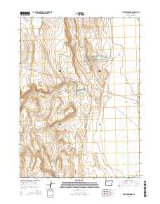
2014 Map of Piute Reservoir
USGS Topo · Published 2014About this map
Guano Valley dominates this high-desert region of Lake County, where seasonal water management and topography dictate the human footprint. The landscape is defined by the elevation of Barry Ridge and the containment of runoff in several basins, including Piute Reservoir, Barry Reservoir, and Little Reservoir. These features are connected by a network of intermittent drainages like Piute Cr, Jack Cr, and Guano Crk, which funnel water through the arid basins. Aside from the state highway Or-140 cutting across the central portion of the sheet, the map reveals a largely open territory organized by the Public Land Survey System, as evidenced by the township lines for t40s r26e and t41s r27e. This 2014 survey serves as a clear record of modern rangeland and water infrastructure in a remote corner of southern Oregon.
Find a feature on this map
13 named features on this map. Tap any name to fly to it.
Don’t see what you’re looking for? This feature index may not catch every label — zoom into the map to look around manually.
Map Details
Editions of this 2014 Piute Reservoir Map
This is the sole edition of this map. No revisions or reprints were ever made.
Other maps of this area

1889 · Long Valley
USGS Topo · 1:250,000

1954 · Vya
USGS Topo · 1:250,000

1955 · Adel
USGS Topo · 1:250,000

1957 · Adel
USGS Topo · 1:250,000

1958 · Vya
USGS Topo · 1:250,000

1958 · Adel
USGS Topo · 1:250,000

1962 · Vya
USGS Topo · 1:250,000

1962 · Adel
USGS Topo · 1:250,000

1966 · Catnip Canyon
USGS Topo · 1:24,000
1966 · Rye Creek
USGS Topo · 1:24,000