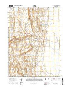
2017 Map of Piute Reservoir
USGS Topo · Published 2017About this map
Piute Reservoir and the surrounding high desert terrain of Lake County define this portion of the eastern Oregon landscape. Fed by the waters of Piute Cr, this catch basin is part of a managed water system that includes Little Reservoir and Barry Reservoir, illustrating the critical role of water storage in this arid environment. The map shows the vast expanse of the Guano Valley to the east, a distinctive geographic feature of the Great Basin region. Human infrastructure is limited to the corridor of Highway 140 and a network of Bureau of Land Management routes, such as BLM RD 7136-0-00 and BLM RD 6106-I, which provide access to this remote cattle-ranching and wildlife territory. Drainage patterns like Jack Cr emphasize the seasonal nature of the local hydrography during the early twenty-first century.
Find a feature on this map
13 named features on this map. Tap any name to fly to it.
Don’t see what you’re looking for? This feature index may not catch every label — zoom into the map to look around manually.
Map Details
Editions of this 2017 Piute Reservoir Map
This is the sole edition of this map. No revisions or reprints were ever made.
Other maps of this area

1889 · Long Valley
USGS Topo · 1:250,000

1954 · Vya
USGS Topo · 1:250,000

1955 · Adel
USGS Topo · 1:250,000

1957 · Adel
USGS Topo · 1:250,000

1958 · Vya
USGS Topo · 1:250,000

1958 · Adel
USGS Topo · 1:250,000

1962 · Vya
USGS Topo · 1:250,000

1962 · Adel
USGS Topo · 1:250,000

1966 · Catnip Canyon
USGS Topo · 1:24,000
1966 · Rye Creek
USGS Topo · 1:24,000