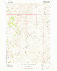
1972 Map of Pixley Basin
USGS Topo · Published 1975About this map
Pixley Basin and Reservation Basin dominate this high-elevation corner of Owyhee County, where deep canyons and ridges define a landscape of historic ranching and mining. Early settlement footprints are visible at Gordy Ranch and the Crill Place, the latter situated near a small Cem that speaks to the isolated life of these uplands. Evidence of mineral exploration appears in the Golden Crown Mine and the Bluebird Mine, while numerous prospects are scattered along Goodman Gulch. The complex drainage network of Castle Creek and its many tributaries, such as Portland Gulch and Pixley Creek, provided essential water in this arid environment. Transportation relied on a network of rugged routes, including the Snake (Pack) Trail and various jeep trails that crossed the Boise Meridian to reach peaks like Toiyabe Mountain and Rough Mountain.
Find a feature on this map
42 named features on this map. Tap any name to fly to it.
Don’t see what you’re looking for? This feature index may not catch every label — zoom into the map to look around manually.
Map Details
Editions of this 1972 Pixley Basin Map
This is the sole edition of this map. No revisions or reprints were ever made.
Other maps of this area

1955 · Jordan Valley
USGS Topo · 1:250,000

1957 · Jordan Valley
USGS Topo · 1:250,000

1958 · Jordan Valley
USGS Topo · 1:250,000

1965 · Triangle
USGS Topo · 1:62,500
1972 · Rough Mountain NE
USGS Topo · 1:24,000
1972 · Rough Mountain
USGS Topo · 1:24,000
1972 · Antelope Spring
USGS Topo · 1:24,000
1972 · Snow Creek
USGS Topo · 1:24,000
1972 · Clover Mtn
USGS Topo · 1:24,000

1973 · Hurry Up Creek
USGS Topo · 1:24,000