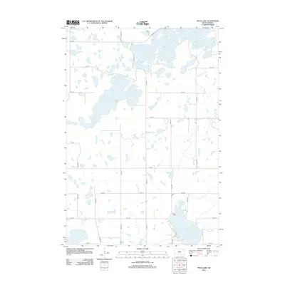
2012 Map of Piyas Lake
USGS Topo · Published 2012About this map
Piyas Lake and the northern reaches of Pickerel Lake dominate this glaciated landscape in the early 21st century. The map reveals a high concentration of prairie potholes and wetlands typical of the region, interspersed with a grid of rural roads like 444th Ave and 128th St. The presence of BIA Road 3 in the northeast and water bodies like Buffalo Lakes reflects the unique geography of the Enemy Swim District. Hydrological features such as Chekepa Cr and the Outlet Dr corridor suggest the natural drainage patterns of this lake-studded terrain. This survey provides a clear view of the section lines and local infrastructure, including Co Hwy-1, which serves as a primary north-south artery through the township divisions.
Find a feature on this map
23 named features on this map. Tap any name to fly to it.
Don’t see what you’re looking for? This feature index may not catch every label — zoom into the map to look around manually.
Map Details
Editions of this 2012 Piyas Lake Map
This is the sole edition of this map. No revisions or reprints were ever made.
Other maps of this area

1953 · Milbank
USGS Topo · 1:250,000

1958 · Milbank
USGS Topo · 1:250,000

1970 · Eden
USGS Topo · 1:24,000

1970 · Whitestone Lake
USGS Topo · 1:24,000

1970 · South Red Iron Lake
USGS Topo · 1:24,000

1970 · Lake City
USGS Topo · 1:24,000

1970 · Piyas Lake
USGS Topo · 1:24,000

1970 · Enemy Swim Lake East
USGS Topo · 1:24,000

1970 · Roslyn
USGS Topo · 1:24,000

1970 · Drywood Lakes
USGS Topo · 1:24,000