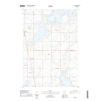
2017 Map of Piyas Lake
USGS Topo · Published 2017About this map
Coteau des Prairies, a vast upland plateau, defines the landscape of this region on the border of Marshall and Day Counties. The area is characterized by a high density of glacial lakes and wetlands, most notably Piyas Lake and the northern reaches of Pickerel Lake. These water bodies dominate the local topography, influencing the winding path of roads like Chekapa Bay Ln and Lakeview Dr. Evidence of the area's social history is found at the Buffalo Lake Cem located near the Buffalo Lakes in the north. The drainage system is anchored by Chekepa Cr, which flows from the southeast. This survey illustrates a quiet, rural landscape structured by the Public Land Survey System, with township lines such as t125n r53w and t124n r54w dividing the lake-strewn plains.
Find a feature on this map
34 named features on this map. Tap any name to fly to it.
Don’t see what you’re looking for? This feature index may not catch every label — zoom into the map to look around manually.
Map Details
Editions of this 2017 Piyas Lake Map
This is the sole edition of this map. No revisions or reprints were ever made.
Other maps of this area

1953 · Milbank
USGS Topo · 1:250,000

1958 · Milbank
USGS Topo · 1:250,000

1970 · Eden
USGS Topo · 1:24,000

1970 · Whitestone Lake
USGS Topo · 1:24,000

1970 · South Red Iron Lake
USGS Topo · 1:24,000

1970 · Lake City
USGS Topo · 1:24,000

1970 · Piyas Lake
USGS Topo · 1:24,000

1970 · Enemy Swim Lake East
USGS Topo · 1:24,000

1970 · Roslyn
USGS Topo · 1:24,000

1970 · Drywood Lakes
USGS Topo · 1:24,000