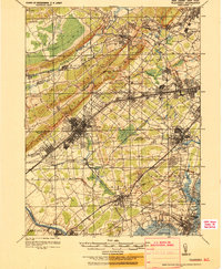
1921 Map of Plainfield
USGS Topo · Published 1921About this map
The Watchung Mountains form a dramatic diagonal spine across this region, separating the low-lying Great Swamp from the industrializing plains below. This tactical survey highlights the significant transit corridors of the early 1920s, dominated by the Pennsylvania RR and the Lehigh Valley RR, which served the growing hubs of North Plainfield and Dunellen.
Find a feature on this map
138 named features on this map. Tap any name to fly to it.
Don’t see what you’re looking for? This feature index may not catch every label — zoom into the map to look around manually.
Map Details
Editions of this 1921 Plainfield Map
This is the sole edition of this map. No revisions or reprints were ever made.
Other maps of this area

1888 · Plainfield
USGS Topo · 1:62,500

1888 · Morristown
USGS Topo · 1:62,500

1888 · New Brunswick
USGS Topo · 1:62,500

1888 · Princeton
USGS Topo · 1:62,500

1888 · Lake Hopatcong
USGS Topo · 1:62,500

1888 · Paterson
USGS Topo · 1:62,500

1888 · Sandy Hook
USGS Topo · 1:62,500

1891 · Somerville
USGS Topo · 1:62,500

1892 · Paterson
USGS Topo · 1:62,500

1893 · New Brunswick
USGS Topo · 1:62,500