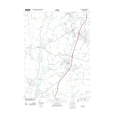
2012 Map of Plainfield
USGS Topo · Published 2012About this map
Peagscomsuck Island sits at a bend in the Quinebaug River, a central landscape feature that historically powered the mill towns of northeastern Connecticut. The river winds through a terrain defined by industry and conservation, passing the Quinebaug Valley Trout Hatchery and several historic bridges such as Canterbury Bridge and Butts Bridge. The settlement pattern centers on the textile legacy of Central Village and West Wauregan, while the village of Plainfield is surrounded by a notable concentration of burial grounds, including the New Plainfield Cem, Old Plainfield Cem, and Saint Johns Cem. To the east, the Moosup River joins the Quinebaug, following the path of the old rail line marked by Wauregan Station. This survey captures the region's character as a network of river-oriented villages, where quiet woodlands are punctuated by family landmarks like Carey Cem and the waters of Stone Hill Reservoir.
Find a feature on this map
184 named features on this map. Tap any name to fly to it.
Don’t see what you’re looking for? This feature index may not catch every label — zoom into the map to look around manually.
Map Details
Editions of this 2012 Plainfield Map
This is the sole edition of this map. No revisions or reprints were ever made.
Other maps of this area

1889 · Putnam
USGS Topo · 1:62,500

1889 · Moosup
USGS Topo · 1:62,500

1892 · Woodstock
USGS Topo · 1:62,500

1892 · Norwich
USGS Topo · 1:62,500

1893 · Putnam
USGS Topo · 1:62,500

1893 · Moosup
USGS Topo · 1:62,500

1919 · Putnam
USGS Topo · 1:62,500

1920 · Moosup
USGS Topo · 1:62,500

1921 · Woodstock
USGS Topo · 1:62,500
1943 · Voluntown
USGS Topo · 1:31,680