
Loading...
Loading map...1889 Map of Moosup
USGS Topo · Published 1889About this map
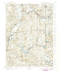
The Connecticut Rhode Island Boundary Line bisects a landscape defined by late 19th-century industrial transit and rural hamlets. The New York and New England Railroad and the Norwich and Worcester Railroad converge at Plainfield Junction, marking the area as a vital transportation hub for New England commerce. Water power from the Moosup River and Quinebaug River supports a string of mill settlements including Almyville, Central Village, and Moosup.
Find a feature on this map
87 named features on this map. Tap any name to fly to it.
Don’t see what you’re looking for? This feature index may not catch every label — zoom into the map to look around manually.
Map Details
Date Portrayed1889
Date Published1889
PublisherU.S. Geological Survey
Map TypeTopographic
Scale1:62,500
Physical Dimensions16.5 x 19.5 inches
Editions of this 1889 Moosup Map
This is the sole edition of this map. No revisions or reprints were ever made.
Historical Maps of Coventry Through Time

Featured Locations
Source Details
SourceU.S. Geological Survey
CopyrightPublic Domain