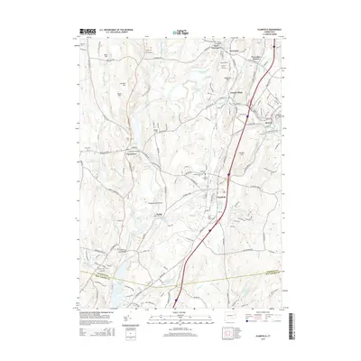
2015 Map of Plainfield
USGS Topo · Published 2015About this map
The Quinebaug River winds through the heart of this landscape, defining the industrial and agricultural development of eastern Connecticut settlements. The river separates the hills of Canterbury from the busy corridors of Plainfield and Moosup, where the Moosup River joins the primary waterway. Local history is deeply etched into the land here through numerous burial grounds, including the clustered Plainfield Cem, New Plainfield Cem, and Old Plainfield Cem. These sites, along with Saint John Cem and Evergreen Cem, offer valuable touchstones for genealogical research in these long-established mill towns.
Find a feature on this map
170 named features on this map. Tap any name to fly to it.
Don’t see what you’re looking for? This feature index may not catch every label — zoom into the map to look around manually.
Map Details
Editions of this 2015 Plainfield Map
This is the sole edition of this map. No revisions or reprints were ever made.
Other maps of this area

1889 · Putnam
USGS Topo · 1:62,500

1889 · Moosup
USGS Topo · 1:62,500

1892 · Woodstock
USGS Topo · 1:62,500

1892 · Norwich
USGS Topo · 1:62,500

1893 · Putnam
USGS Topo · 1:62,500

1893 · Moosup
USGS Topo · 1:62,500

1919 · Putnam
USGS Topo · 1:62,500

1920 · Moosup
USGS Topo · 1:62,500

1921 · Woodstock
USGS Topo · 1:62,500
1943 · Voluntown
USGS Topo · 1:31,680