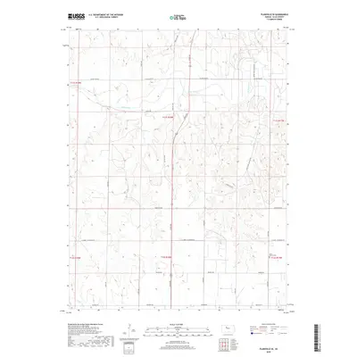
2018 Map of Plainville SE
USGS Topo · Published 2018About this map
The Saline River winds across this Ellis County landscape, carving a wide valley through the plains north of the N Fork Big Cr. This area is characterized by a precise grid of rural thoroughfares, including Saline River Rd and Severin Rd, which define the agricultural boundaries of the township and range system. In the southeastern reaches, the Saint Severin Cem stands as a significant point of local heritage near the junction of 280th Ave. The terrain is marked by notable drainage patterns from secondary waterways like Sand Cr and the descriptively named Horse Thief Canyon Ave. This 2018 survey illustrates the enduring rural structure of the region, where legacy roads such as Homestead Rd and St John - St Andrew Rd connect disparate farmsteads across the Kansas prairie.
Find a feature on this map
23 named features on this map. Tap any name to fly to it.
Don’t see what you’re looking for? This feature index may not catch every label — zoom into the map to look around manually.
Map Details
Editions of this 2018 Plainville SE Map
This is the sole edition of this map. No revisions or reprints were ever made.
Other maps of this area

1896 · Hays
USGS Topo · 1:125,000

1896 · Plainville
USGS Topo · 1:125,000

1955 · Great Bend
USGS Topo · 1:250,000

1955 · Beloit
USGS Topo · 1:250,000

1957 · Great Bend
USGS Topo · 1:250,000

1958 · Great Bend
USGS Topo · 1:250,000

1959 · Beloit
USGS Topo · 1:250,000

1961 · Yocemento
USGS Topo · 1:24,000

1961 · Catharine
USGS Topo · 1:24,000
1961 · Hays North
USGS Topo · 1:24,000