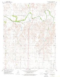
1978 Map of Plainville SE
USGS Topo · Published 1979About this map
The Saline River winds through the northern section of this Ellis County landscape, carving a valley defined by prominent features like Bluff and the entry of Sand Creek. By the late 1970s, this area was heavily defined by energy extraction, with the expansive Bemis Shutts Oil Field and the Buckeye field occupying vast stretches of the terrain. The network of section roads and oil well pads contrasts with the traditional rural layout, showing how the petroleum industry integrated into the agricultural grid.
Find a feature on this map
15 named features on this map. Tap any name to fly to it.
Don’t see what you’re looking for? This feature index may not catch every label — zoom into the map to look around manually.
Map Details
Editions of this 1978 Plainville SE Map
This is the sole edition of this map. No revisions or reprints were ever made.
Other maps of this area

1896 · Hays
USGS Topo · 1:125,000

1896 · Plainville
USGS Topo · 1:125,000

1955 · Great Bend
USGS Topo · 1:250,000

1955 · Beloit
USGS Topo · 1:250,000

1957 · Great Bend
USGS Topo · 1:250,000

1958 · Great Bend
USGS Topo · 1:250,000

1959 · Beloit
USGS Topo · 1:250,000

1961 · Yocemento
USGS Topo · 1:24,000

1961 · Catharine
USGS Topo · 1:24,000
1961 · Hays North
USGS Topo · 1:24,000