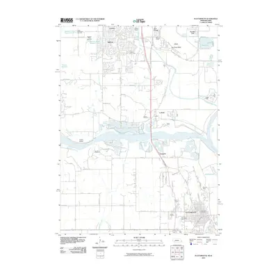
2010 Map of Plattsmouth
USGS Topo · Published 2010About this map
The Missouri River and Platte River converge in this eastern Nebraska corridor, shaping the development of Plattsmouth and its northern neighbors. The landscape is a mix of strategic military infrastructure and riverine bottomlands, dominated by the sprawling Offutt Air Force Base and the historic site of Fort Crook. In the lowlands near the confluence, the smaller settlements of La Platte and Oreapolis sit amidst a network of drainage ways like Zwiebel Creek and Fourmile Creek. Genealogists will find the La Platte Cemetery and Oak Hill Cemetery well-defined, while researchers of local recreation can identify early 21st-century landmarks such as Eppley Camp, Immanuel Camp, and several golf courses including Willow Lakes and Tregaron. The map also details water management features like Papillion Creek Reservoir S-31 and the Detention Dam 10-A near the Plattsmouth city center.
Find a feature on this map
58 named features on this map. Tap any name to fly to it.
Don’t see what you’re looking for? This feature index may not catch every label — zoom into the map to look around manually.
Map Details
Editions of this 2010 Plattsmouth Map
This is the sole edition of this map. No revisions or reprints were ever made.
Other maps of this area

1893 · Fremont
USGS Topo · 1:125,000

1896 · Fremont
USGS Topo · 1:125,000

1903 · Weeping Water
USGS Topo · 1:125,000

1929 · Weeping Water
USGS Topo · 1:125,000

1935 · Nehawka
USGS Topo · 1:48,000

1940 · Nehawka
USGS Topo · 1:62,500

1954 · Omaha
USGS Topo · 1:250,000

1955 · Fremont
USGS Topo · 1:250,000

1955 · Nebraska City
USGS Topo · 1:250,000

1955 · Lincoln
USGS Topo · 1:250,000