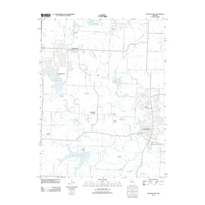
2012 Map of Pleasant Hill
USGS Topo · Published 2012About this map
Pleasant Hill serves as the primary municipal center in this 2012 survey, situated at the intersection of a developing suburban landscape and traditional Missouri agricultural land. The map illustrates a region defined by complex water management, from the sprawling Lake Winnebago in the west to smaller impoundments like Rock Island Lake and Harrisonville City Lake in the south. These bodies of water, along with the meandering path of Big Creek, influence the local layout and residential expansion around the older cores of Greenwood and Avon.
Find a feature on this map
88 named features on this map. Tap any name to fly to it.
Don’t see what you’re looking for? This feature index may not catch every label — zoom into the map to look around manually.
Map Details
Editions of this 2012 Pleasant Hill Map
This is the sole edition of this map. No revisions or reprints were ever made.
Other maps of this area

1887 · Harrisonville
USGS Topo · 1:125,000

1892 · Harrisonville
USGS Topo · 1:125,000

1894 · Harrisonville
USGS Topo · 1:125,000

1934 · Lees Summit
USGS Topo · 1:24,000

1934 · Woods Chapel
USGS Topo · 1:24,000

1935 · Tarsney
USGS Topo · 1:24,000

1939 · Lees Summit
USGS Topo · 1:31,680

1947 · Lawrence
USGS Topo · 1:250,000
1949 · Lees Summit
USGS Topo · 1:24,000

1950 · Lawrence
USGS Topo · 1:250,000