
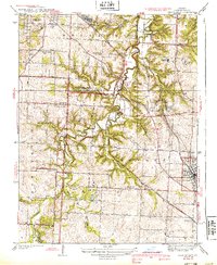
1939 Map of Lees Summit
USGS Topo · Published 1939About this map
The Little Blue River winds through the rural heart of Jackson County, anchoring a landscape defined by small agrarian communities and a dense network of one-room schoolhouses like Stony Point Sch and Oakland Sch. As the 1930s drew to a close, the Chicago Rock Island and Pacific railroad served as the primary industrial artery, connecting the established center of Lees Summit with outlying settlements like Knobtown, Vale, and South Lee.
Find a feature on this map
34 named features on this map. Tap any name to fly to it.
Don’t see what you’re looking for? This feature index may not catch every label — zoom into the map to look around manually.
Map Details
Editions of this 1939 Lees Summit Map
3 editions found
Other maps of this area

1887 · Harrisonville
USGS Topo · 1:125,000

1887 · Olathe
USGS Topo · 1:125,000

1890 · Kansas City
USGS Topo · 1:125,000

1892 · Harrisonville
USGS Topo · 1:125,000

1893 · Olathe
USGS Topo · 1:125,000

1894 · Kansas City
USGS Topo · 1:125,000

1894 · Harrisonville
USGS Topo · 1:125,000

1894 · Independence
USGS Topo · 1:125,000

1933 · Blue Springs
USGS Topo · 1:24,000

1934 · Independence
USGS Topo · 1:24,000