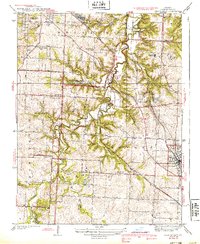
1939 Map of Lees Summit
USGS Topo · Published 1939About this map
Little Blue River meanders through the central Jackson County landscape, anchoring a network of small settlements and rural institutions in the late 1930s. The area shows a transition between early aviation and established rail corridors, with Gregory Landing Field situated near the north, while the Chicago Rock Island and Pacific and Missouri Pacific railroads serve the growing town of Lees Summit.
Find a feature on this map
40 named features on this map. Tap any name to fly to it.
Don’t see what you’re looking for? This feature index may not catch every label — zoom into the map to look around manually.
Map Details
Editions of this 1939 Lees Summit Map
3 editions found

Other maps of this area

1887 · Harrisonville
USGS Topo · 1:125,000

1887 · Olathe
USGS Topo · 1:125,000

1890 · Kansas City
USGS Topo · 1:125,000

1892 · Harrisonville
USGS Topo · 1:125,000

1893 · Olathe
USGS Topo · 1:125,000

1894 · Kansas City
USGS Topo · 1:125,000

1894 · Harrisonville
USGS Topo · 1:125,000

1894 · Independence
USGS Topo · 1:125,000

1933 · Blue Springs
USGS Topo · 1:24,000

1934 · Independence
USGS Topo · 1:24,000