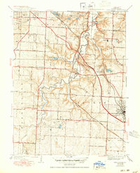
1939 Map of Lees Summit
USGS Topo · Published 1950About this map
Lees Summit serves as the focal point of this Jackson County survey, showcasing a landscape defined by the winding course of the Little Blue River and its various tributaries like Mouse Creek. The region exhibits a mid-century rural-to-suburban character, with traditional farming tracts in Prairie and Brooking townships beginning to shift around established nodes like Knobtown and Vale. Significant social infrastructure is evident through a high density of rural schoolhouses, including Stony Point Sch, Oakland Sch, and Cedar Hill Sch, reflecting the community's localized educational network before the consolidation era.
Find a feature on this map
38 named features on this map. Tap any name to fly to it.
Don’t see what you’re looking for? This feature index may not catch every label — zoom into the map to look around manually.
Map Details
Editions of this 1939 Lees Summit Map
3 editions found

Other maps of this area

1887 · Harrisonville
USGS Topo · 1:125,000

1887 · Olathe
USGS Topo · 1:125,000

1890 · Kansas City
USGS Topo · 1:125,000

1892 · Harrisonville
USGS Topo · 1:125,000

1893 · Olathe
USGS Topo · 1:125,000

1894 · Kansas City
USGS Topo · 1:125,000

1894 · Harrisonville
USGS Topo · 1:125,000

1894 · Independence
USGS Topo · 1:125,000

1933 · Blue Springs
USGS Topo · 1:24,000

1934 · Independence
USGS Topo · 1:24,000