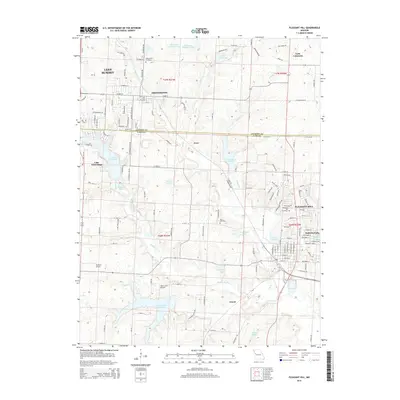
2015 Map of Pleasant Hill
USGS Topo · Published 2015About this map
Lees Summit and Pleasant Hill anchor this map of the western Missouri borderlands, where the transition from suburban expansion to rural landscapes is marked by a complex network of reservoirs and water bodies. Significant features include Lake Winnebago and Lake Lotawana, alongside numerous smaller impoundments like Swan Lake, Loch Leonard, and Rock Island Lake that punctuate the drainage basins of Big Creek and Middle Big Creek. The presence of the Rock Island railroad line and the established center of Greenwood highlight the corridor's long-standing transportation significance.
Find a feature on this map
82 named features on this map. Tap any name to fly to it.
Don’t see what you’re looking for? This feature index may not catch every label — zoom into the map to look around manually.
Map Details
Editions of this 2015 Pleasant Hill Map
This is the sole edition of this map. No revisions or reprints were ever made.
Other maps of this area

1887 · Harrisonville
USGS Topo · 1:125,000

1892 · Harrisonville
USGS Topo · 1:125,000

1894 · Harrisonville
USGS Topo · 1:125,000

1934 · Lees Summit
USGS Topo · 1:24,000

1934 · Woods Chapel
USGS Topo · 1:24,000

1935 · Tarsney
USGS Topo · 1:24,000

1939 · Lees Summit
USGS Topo · 1:31,680

1947 · Lawrence
USGS Topo · 1:250,000
1949 · Lees Summit
USGS Topo · 1:24,000

1950 · Lawrence
USGS Topo · 1:250,000