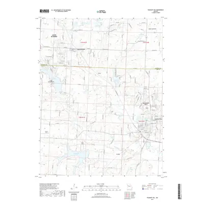
2017 Map of Pleasant Hill
USGS Topo · Published 2017About this map
Pleasant Hill and Greenwood anchor this 2017 landscape along the border of Jackson and Cass Counties, where suburban expansion meets the organized hydrology of the Missouri plains. The area is defined by an extensive network of reservoirs and small lakes, ranging from the large residential waters of Lake Winnebago and Lake Lotawana to the managed basins of Reed Area Number 10 Lake and Harrisonville City Lake. The topographic detail reveals a terrain shaped by Middle Big Creek and its tributaries, interspersed with local aviation hubs like Riordan Airport and Inter- State Airport.
Find a feature on this map
76 named features on this map. Tap any name to fly to it.
Don’t see what you’re looking for? This feature index may not catch every label — zoom into the map to look around manually.
Map Details
Editions of this 2017 Pleasant Hill Map
This is the sole edition of this map. No revisions or reprints were ever made.
Other maps of this area

1887 · Harrisonville
USGS Topo · 1:125,000

1892 · Harrisonville
USGS Topo · 1:125,000

1894 · Harrisonville
USGS Topo · 1:125,000

1934 · Lees Summit
USGS Topo · 1:24,000

1934 · Woods Chapel
USGS Topo · 1:24,000

1935 · Tarsney
USGS Topo · 1:24,000

1939 · Lees Summit
USGS Topo · 1:31,680

1947 · Lawrence
USGS Topo · 1:250,000
1949 · Lees Summit
USGS Topo · 1:24,000

1950 · Lawrence
USGS Topo · 1:250,000