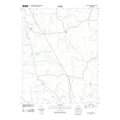
2010 Map of Pleasant Ridge
USGS Topo · Published 2010About this map
Pleasant Ridge and the surrounding rural landscapes of Ohio County are defined by a network of creeks and small family settlements. The terrain is marked by prominent elevations such as Hoover Hill and Whoopee Hill, while water systems like Barnett Creek and Greasy Creek drain toward the Rough River in the southeast. For genealogists, the landscape preserves several family-named burial grounds, including the Dodson Cemetery, Shown Cemetery, and Ashley Cemetery, which provide anchors for local family histories. The Green River Pkwy cuts through the center of the region, contrasting modern transit with the established road networks connecting Bells Run, Beda, and Buford. Small water bodies like Maple Leaf Lake and the aptly named Crooked Pond dot the drainage basins, illustrating the low-lying wetlands that characterize the southern portion of the quadrangle.
Find a feature on this map
57 named features on this map. Tap any name to fly to it.
Don’t see what you’re looking for? This feature index may not catch every label — zoom into the map to look around manually.
Map Details
Editions of this 2010 Pleasant Ridge Map
This is the sole edition of this map. No revisions or reprints were ever made.
Other maps of this area

1906 · Sutherland
USGS Topo · 1:62,500

1907 · Whitesville
USGS Topo · 1:62,500

1909 · Whitesville
USGS Topo · 1:62,500

1909 · Hartford
USGS Topo · 1:62,500

1909 · Central City
USGS Topo · 1:62,500

1952 · Equality
USGS Topo · 1:24,000

1953 · Philpot
USGS Topo · 1:24,000

1953 · Sutherland
USGS Topo · 1:24,000

1953 · Utica
USGS Topo · 1:24,000

1953 · Dundee
USGS Topo · 1:24,000