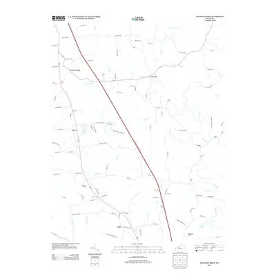
2013 Map of Pleasant Ridge
USGS Topo · Published 2013About this map
Pleasant Ridge and its surrounding hamlets in Ohio County are bisected by the prominent corridor of the William H. Natcher Pkwy S. This rural Kentucky landscape is defined by its ridge-and-hollow geography, where small settlements like Bells Run, Buford, and Beda follow the drainage patterns of waterways such as Flat Br and Barnett Cr. The map reveals a dense network of local roads and family-named landmarks, such as Hoover Hill and Whoopee Hill, reflecting a deep-rooted agricultural and rural community. Genealogists will find significant value in the distribution of family burial sites across the terrain, including Dodson Cem, Shown Cem, and Ashley Cem. To the southeast, the landscape transitions toward the winding course of the Rough River and Crooked Pond, illustrating the natural water boundaries that have historically influenced land division and movement in this part of the state.
Find a feature on this map
93 named features on this map. Tap any name to fly to it.
Don’t see what you’re looking for? This feature index may not catch every label — zoom into the map to look around manually.
Map Details
Editions of this 2013 Pleasant Ridge Map
This is the sole edition of this map. No revisions or reprints were ever made.
Other maps of this area

1906 · Sutherland
USGS Topo · 1:62,500

1907 · Whitesville
USGS Topo · 1:62,500

1909 · Whitesville
USGS Topo · 1:62,500

1909 · Hartford
USGS Topo · 1:62,500

1909 · Central City
USGS Topo · 1:62,500

1952 · Equality
USGS Topo · 1:24,000

1953 · Philpot
USGS Topo · 1:24,000

1953 · Sutherland
USGS Topo · 1:24,000

1953 · Utica
USGS Topo · 1:24,000

1953 · Dundee
USGS Topo · 1:24,000