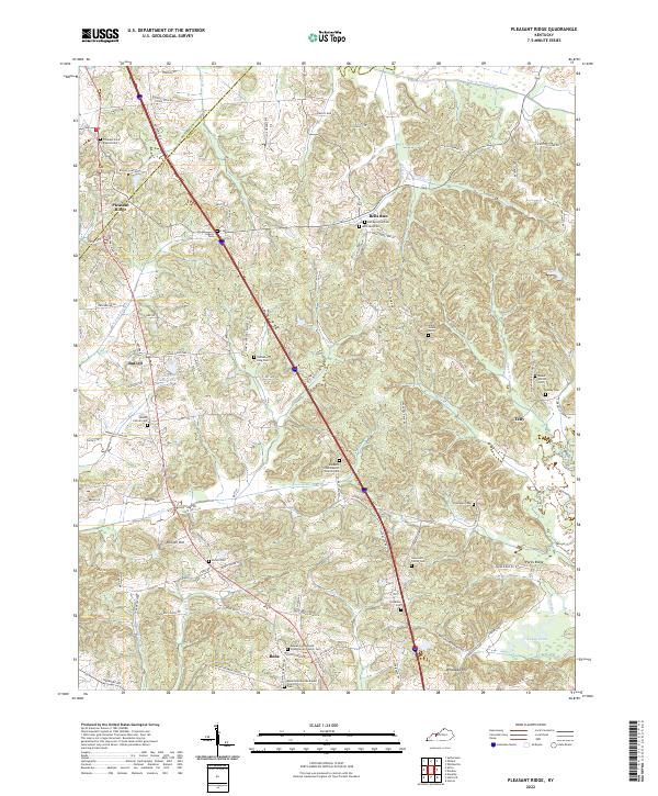
2022 Map of Pleasant Ridge
USGS Topo · Published 2022About this map
Barnetts Creek Baptist Church and its accompanying cemetery sit central to this landscape on the border of Daviess and Ohio Counties. The region is defined by a dense network of family-named landmarks and rural settlements, including Pleasant Ridge, Bells Run, and Buford. Genealogists will find a high concentration of burial sites such as the Newcomb Family Cem, Patterson Cem, and the Dodson King Cem near the winding course of Barnett Cr. The terrain transitions from the elevations of Hoover Hill toward the southern lowlands of the Rough River and Crooked Pond. Traditional local road networks like Harmons Ferry Rd and Old Mill Cemetery Rd trace the historical movement between small communities like Beda and Taffy, reflecting the area's long-standing agricultural character and decentralized settlement patterns.
Find a feature on this map
98 named features on this map. Tap any name to fly to it.
Don’t see what you’re looking for? This feature index may not catch every label — zoom into the map to look around manually.
Map Details
Editions of this 2022 Pleasant Ridge Map
This is the sole edition of this map. No revisions or reprints were ever made.
Other maps of this area

1906 · Sutherland
USGS Topo · 1:62,500

1907 · Whitesville
USGS Topo · 1:62,500

1909 · Whitesville
USGS Topo · 1:62,500

1909 · Hartford
USGS Topo · 1:62,500

1909 · Central City
USGS Topo · 1:62,500

1952 · Equality
USGS Topo · 1:24,000

1953 · Philpot
USGS Topo · 1:24,000

1953 · Sutherland
USGS Topo · 1:24,000

1953 · Utica
USGS Topo · 1:24,000

1953 · Dundee
USGS Topo · 1:24,000