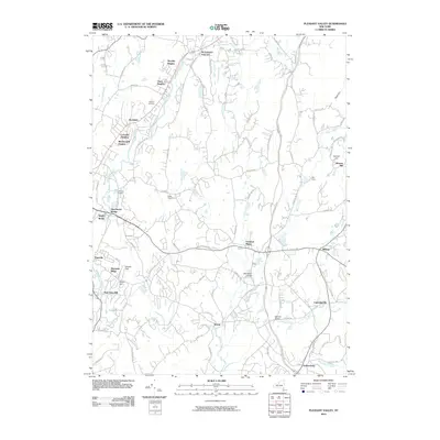
2010 Map of Pleasant Valley
USGS Topo · Published 2010About this map
Wappinger Creek winds through this central Dutchess County landscape, serving as a primary corridor for the communities of Pleasant Valley and Manchester Bridge. The terrain transitions from the residential developments of Timothy Heights and Colonial Heights in the north to the more open reaches near Freedom Plains and Lagrangeville to the south. Historically significant infrastructure like Stringham Bridge and Montfort Bridge spans the local waterways, while established sites like Beth-El Cemetery and LaGrange Cemetery offer vital reference points for genealogical research.
Find a feature on this map
91 named features on this map. Tap any name to fly to it.
Don’t see what you’re looking for? This feature index may not catch every label — zoom into the map to look around manually.
Map Details
Editions of this 2010 Pleasant Valley Map
This is the sole edition of this map. No revisions or reprints were ever made.
Other maps of this area

1893 · Clove
USGS Topo · 1:62,500

1893 · Poughkeepsie
USGS Topo · 1:62,500

1894 · Clove
USGS Topo · 1:62,500

1894 · Poughkeepsie
USGS Topo · 1:62,500

1898 · Clove
USGS Topo · 1:62,500

1898 · Rhinebeck
USGS Topo · 1:62,500

1899 · Millbrook
USGS Topo · 1:62,500

1901 · Clove
USGS Topo · 1:62,500

1902 · Millbrook
USGS Topo · 1:62,500

1903 · Poughkeepsie
USGS Topo · 1:62,500