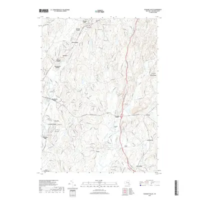
2019 Map of Pleasant Valley
USGS Topo · Published 2019About this map
Wappinger Creek and its tributaries carve through this section of Dutchess County, anchoring a landscape where residential developments like Timothy Heights and Colonial Heights meet older milling sites. The map reveals a dense network of suburban expansion near Poughkeepsie, yet maintains clear records of early community foundations through numerous burial grounds, including the Pleasant Valley Presbyterian Cem and Friends Cem. The transition from industrial hamlets to modern townships is evident in the cluster of settlements such as Manchester Bridge and Titusville. Southeast of the main creek, Sprout Creek winds past Noxon and Arthursburg, highlighting the more dispersed rural character that persists alongside growing residential tracts. Significant crossings like the Stringham Bridge and Montfor Bridge provide a window into the local infrastructure connecting these historic neighborhoods.
Find a feature on this map
177 named features on this map. Tap any name to fly to it.
Don’t see what you’re looking for? This feature index may not catch every label — zoom into the map to look around manually.
Map Details
Editions of this 2019 Pleasant Valley Map
This is the sole edition of this map. No revisions or reprints were ever made.
Other maps of this area

1893 · Clove
USGS Topo · 1:62,500

1893 · Poughkeepsie
USGS Topo · 1:62,500

1894 · Clove
USGS Topo · 1:62,500

1894 · Poughkeepsie
USGS Topo · 1:62,500

1898 · Clove
USGS Topo · 1:62,500

1898 · Rhinebeck
USGS Topo · 1:62,500

1899 · Millbrook
USGS Topo · 1:62,500

1901 · Clove
USGS Topo · 1:62,500

1902 · Millbrook
USGS Topo · 1:62,500

1903 · Poughkeepsie
USGS Topo · 1:62,500