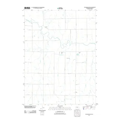
2011 Map of Pleasanton NW
USGS Topo · Published 2011About this map
The South Loup River winds across this section of Buffalo County, defining the rural geography near the settlement of Sartoria. This 2011 survey reveals a landscape primarily organized by a rigid grid of country roads, including Sartoria Rd, Husker Rd, and Grand Island Rd. Water management is central to the area's agricultural character, evidenced by the presence of the Zwiener Reservoir and Rohrich Reservoir, along with their associated dams. For those researching local family history, the Peaks Cemetery sits in the southeastern portion of the map, providing a specific point of reference for genealogical study. The drainage of the region is further detailed by Swenson Creek, Deer Creek, and Rusco Creek, which feed into the primary river valley.
Find a feature on this map
27 named features on this map. Tap any name to fly to it.
Don’t see what you’re looking for? This feature index may not catch every label — zoom into the map to look around manually.
Map Details
Editions of this 2011 Pleasanton NW Map
This is the sole edition of this map. No revisions or reprints were ever made.
Other maps of this area

1896 · Kearney
USGS Topo · 1:125,000

1951 · Litchfield SW
USGS Topo · 1:24,000

1951 · Hazard
USGS Topo · 1:24,000

1951 · Mason City SE
USGS Topo · 1:24,000

1955 · Broken Bow
USGS Topo · 1:250,000

1955 · Grand Island
USGS Topo · 1:250,000

1956 · Broken Bow
USGS Topo · 1:250,000

1957 · Grand Island
USGS Topo · 1:250,000

1958 · Grand Island
USGS Topo · 1:250,000

1961 · Amherst
USGS Topo · 1:24,000