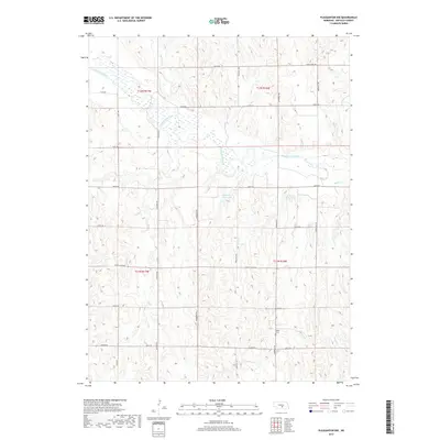
2017 Map of Pleasanton NW
USGS Topo · Published 2017About this map
The South Loup River meanders across this rural section of Buffalo County, carving a distinct valley through the Nebraska prairie. This 2017 survey reveals a landscape primarily organized by the Public Land Survey System, with a rigid grid of gravel and section-line roads such as Sartoria Rd and Grand Island Rd defining the agricultural territory. Genealogists and local historians can locate the Peaks Cem, situated along Riverdale Rd in the southeastern portion of the map. The drainage of the region is further defined by Swenson Cr and Rusco Cr, while human-engineered water management is evident in the presence of the Zwiener Reservoir and Rohrich Reservoir. The map illustrates the contemporary intersection of traditional ranching or farming tracts with modern infrastructure, including roads like Husker Rd.
Find a feature on this map
27 named features on this map. Tap any name to fly to it.
Don’t see what you’re looking for? This feature index may not catch every label — zoom into the map to look around manually.
Map Details
Editions of this 2017 Pleasanton NW Map
This is the sole edition of this map. No revisions or reprints were ever made.
Other maps of this area

1896 · Kearney
USGS Topo · 1:125,000

1951 · Litchfield SW
USGS Topo · 1:24,000

1951 · Hazard
USGS Topo · 1:24,000

1951 · Mason City SE
USGS Topo · 1:24,000

1955 · Broken Bow
USGS Topo · 1:250,000

1955 · Grand Island
USGS Topo · 1:250,000

1956 · Broken Bow
USGS Topo · 1:250,000

1957 · Grand Island
USGS Topo · 1:250,000

1958 · Grand Island
USGS Topo · 1:250,000

1961 · Amherst
USGS Topo · 1:24,000