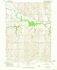
1962 Map of Pleasanton NW
USGS Topo · Published 1964About this map
The South Loup River carves a winding path through the heart of Buffalo County in this early 1960s study, defining a landscape of transition between the river bottoms and the surrounding high ground. The small settlement of Sartoria serves as a local anchor along the river's northern banks, while a series of numbered rural schools—including School No 73, School No 45, and School No 80—reveal the distributed nature of the county's educational and social network during this era. The map provides remarkable detail for genealogists, showing the precise locations of farmsteads and field lines across the townships of Sartoria, Loup, Scott, and Rusco. In the southeastern portion of the quadrangle, Rusco Creek and the Peake Cem offer further points of reference for those tracing early families in this agricultural region.
Find a feature on this map
13 named features on this map. Tap any name to fly to it.
Don’t see what you’re looking for? This feature index may not catch every label — zoom into the map to look around manually.
Map Details
Editions of this 1962 Pleasanton NW Map
This is the sole edition of this map. No revisions or reprints were ever made.
Other maps of this area

1896 · Kearney
USGS Topo · 1:125,000

1951 · Litchfield SW
USGS Topo · 1:24,000

1951 · Hazard
USGS Topo · 1:24,000

1951 · Mason City SE
USGS Topo · 1:24,000

1955 · Broken Bow
USGS Topo · 1:250,000

1955 · Grand Island
USGS Topo · 1:250,000

1956 · Broken Bow
USGS Topo · 1:250,000

1957 · Grand Island
USGS Topo · 1:250,000

1958 · Grand Island
USGS Topo · 1:250,000

1961 · Amherst
USGS Topo · 1:24,000