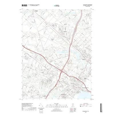
2019 Map of Pleasantville
USGS Topo · Published 2019About this map
Atlantic City International Airport and the sprawling Atlantic City Reservoir dominate the central landscape of this Atlantic County region. The map reveals a dense corridor of infrastructure and history, where the modern routes of the Atlantic City Expy and Garden State Pkwy intersect with long-established settlements like Absecon and Pleasantville. For genealogists and local historians, the sheet is exceptionally detailed in its documentation of burial grounds, including the Beth Kehillah Cem, Rodef Sholom Cem, and the massive Mount Calvary Cem. To the south, the landscape transitions into the waters of Lakes Bay near Bargaintown, while the northern reaches include Stockton University and the community of Pomona. The intricate network of waterways, from Absecon Creek to Patcong Lake, highlights the coastal wetland character that has long defined development in this part of New Jersey.
Find a feature on this map
37 named features on this map. Tap any name to fly to it.
Don’t see what you’re looking for? This feature index may not catch every label — zoom into the map to look around manually.
Map Details
Editions of this 2019 Pleasantville Map
This is the sole edition of this map. No revisions or reprints were ever made.
Other maps of this area

1887 · Atlantic City
USGS Topo · 1:62,500

1888 · Little Egg Harbor
USGS Topo · 1:62,500

1890 · Great Egg Harbor
USGS Topo · 1:62,500

1890 · Mullica
USGS Topo · 1:62,500

1893 · Great Egg Harbor
USGS Topo · 1:62,500

1893 · Little Egg Harbor
USGS Topo · 1:62,500

1894 · Atlantic City
USGS Topo · 1:62,500

1894 · Mullica
USGS Topo · 1:62,500

1898 · Mullica
USGS Topo · 1:62,500

1900 · Rancocas
USGS Topo · 1:125,000