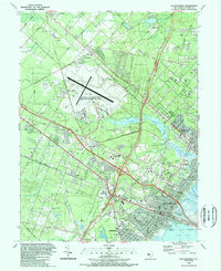
1989 Map of Pleasantville
USGS Topo · Published 1989About this map
Northfield and Pleasantville serve as the primary suburban hubs in this late-century coastal New Jersey survey, situated just inland from Lakes Bay. The landscape is defined by the significant infrastructure of the NAFEC-Atlantic City International Airport and the convergence of the Garden State Parkway and the Atlantic City Expressway. This era shows a transition from the agricultural roots of Germania and Bargaintown toward dense residential and commercial expansion, evidenced by the large Shore Mall and Drive-in Theater along the highway corridors.
Find a feature on this map
84 named features on this map. Tap any name to fly to it.
Don’t see what you’re looking for? This feature index may not catch every label — zoom into the map to look around manually.
Map Details
Editions of this 1989 Pleasantville Map
This is the sole edition of this map. No revisions or reprints were ever made.
Other maps of this area

1887 · Atlantic City
USGS Topo · 1:62,500

1888 · Little Egg Harbor
USGS Topo · 1:62,500

1890 · Great Egg Harbor
USGS Topo · 1:62,500

1890 · Mullica
USGS Topo · 1:62,500

1893 · Great Egg Harbor
USGS Topo · 1:62,500

1893 · Little Egg Harbor
USGS Topo · 1:62,500

1894 · Atlantic City
USGS Topo · 1:62,500

1894 · Mullica
USGS Topo · 1:62,500

1898 · Mullica
USGS Topo · 1:62,500

1900 · Rancocas
USGS Topo · 1:125,000