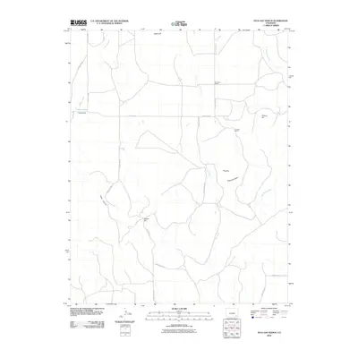
2010 Map of Plug Hat Ranch
USGS Topo · Published 2010About this map
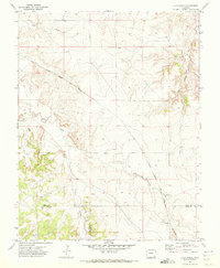
Plug Hat Ranch and H Heart Ranch anchor this landscape in rural Las Animas County, where the high plains terrain is defined by mesas and shifting watercourses. The presence of the Dry Creek School north of Alexander Mesa suggests a historically dispersed ranching community connected by a network of county roads, including County Rd-82 and County Rd-211. The topography is marked by distinctive elevation changes at Eagle Cliff and Nelson Hill, with drainage patterns moving through Cahill Canyon and into Dry Creek. Water is a critical and localized resource here, evidenced by the named Alkali Holes near Johnny Creek. This 2010 survey reflects a region where land use remains dedicated to large-scale livestock operations and sparse habitation among the prominent landmarks like Pinkney Hill.
Find a feature on this map
23 named features on this map. Tap any name to fly to it.
Don’t see what you’re looking for? This feature index may not catch every label — zoom into the map to look around manually.
Map Details
Editions of this 2010 Plug Hat Ranch Map
This is the sole edition of this map. No revisions or reprints were ever made.
Other maps of this area

1891 · Higbee
USGS Topo · 1:125,000

1892 · Mt Carrizo
USGS Topo · 1:125,000

1893 · Higbee
USGS Topo · 1:125,000

1955 · La Junta
USGS Topo · 1:250,000

1958 · La Junta
USGS Topo · 1:250,000

1968 · La Junta
USGS Topo · 1:250,000
1971 · Ninaview
USGS Topo · 1:24,000
1971 · Walker Canyon
USGS Topo · 1:24,000
1971 · Plug Hat Ranch
USGS Topo · 1:24,000
1971 · Clay Ranch
USGS Topo · 1:24,000