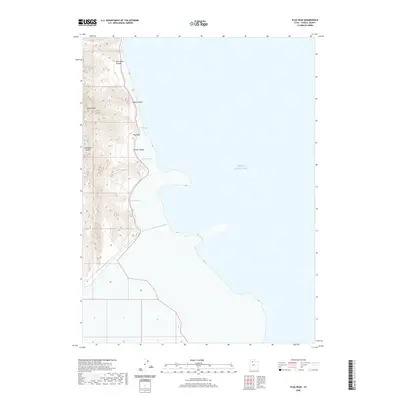
2020 Map of Plug Peak
USGS Topo · Published 2020About this map
Stansbury Island rises sharply from the western reaches of the Great Salt Lake, defining a landscape of high desert ridges and isolated water sources. This 2020 survey documents the intricate topography of the island's eastern flank, where the prominent summit of Plug Peak overlooks a series of rugged drainages including Ben Allen Canyon and Shanty Canyon. The shoreline is characterized by distinct indentations like Cradle Bay and Stansbury Bight, marking the boundary between the salt flats and the upland interior. Essential water points such as Cane Spring and Shanty Spring are critical landmarks in this arid environment, while the massive monolith of Castle Rock stands as a notable geological feature. The map details the transition from the hypersaline waters of the lake to the steep, canyon-scored slopes of the island's central spine.
Find a feature on this map
11 named features on this map. Tap any name to fly to it.
Don’t see what you’re looking for? This feature index may not catch every label — zoom into the map to look around manually.
Map Details
Editions of this 2020 Plug Peak Map
This is the sole edition of this map. No revisions or reprints were ever made.
Other maps of this area

1885 · Tooele Valley
USGS Topo · 1:250,000

1953 · Tooele
USGS Topo · 1:250,000

1955 · Timpie
USGS Topo · 1:62,500

1955 · Mills Junction
USGS Topo · 1:24,000

1955 · Burmester
USGS Topo · 1:24,000

1955 · Tooele
USGS Topo · 1:250,000

1968 · Plug Peak SE
USGS Topo · 1:24,000

1968 · Plug Peak NW
USGS Topo · 1:24,000

1968 · Badger Island
USGS Topo · 1:24,000

1968 · Corral Canyon
USGS Topo · 1:24,000