
1968 Map of Badger Island
USGS Topo · Published 1973About this map
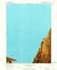
Stansbury Island and its relationship to the changing water levels of the Great Salt Lake define this orthophotomap, which utilizes 1969 aerial photography to document the landscape. The imagery captures the expansive Mud Flat areas that connect the landmasses when the water is low, specifically noting a Normal Pool Elevation 4193. Human infrastructure in this desert environment is sparse, centered primarily around a Pumping Station and a Jeep Trail that navigates the terrain near Pass Canyon.
Find a feature on this map
12 named features on this map. Tap any name to fly to it.
Don’t see what you’re looking for? This feature index may not catch every label — zoom into the map to look around manually.
Map Details
Editions of this 1968 Badger Island Map
This is the sole edition of this map. No revisions or reprints were ever made.
Other maps of this area

1885 · Tooele Valley
USGS Topo · 1:250,000

1953 · Tooele
USGS Topo · 1:250,000

1954 · Brigham City
USGS Topo · 1:250,000

1955 · Tooele
USGS Topo · 1:250,000

1958 · Brigham City
USGS Topo · 1:250,000

1962 · Brigham City
USGS Topo · 1:250,000

1968 · Plug Peak NW
USGS Topo · 1:24,000
1968 · Carrington Island SW
USGS Topo · 1:24,000
1968 · Fremont Island SW
USGS Topo · 1:24,000

1968 · Poverty Point
USGS Topo · 1:24,000