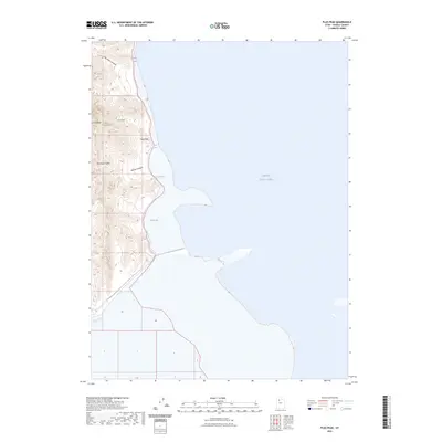
2023 Map of Plug Peak
USGS Topo · Published 2023About this map
Stansbury Island rises prominently from the western reaches of the Great Salt Lake, defining a landscape where steep elevation meets the vast salt flats and shorelines of Tooele County. This modern survey details the landform's central heights, including the summit of Plug Peak and the distinctive formation at Castle Rock. The eastern shoreline is shaped by the indentations of Stansbury Bight and Cradle Bay, where the transition from mountainous terrain to the lake bed is immediate and stark. Deeply etched drainages like Ben Allen Canyon, Cane Canyon, and Shanty Canyon cut through the island's interior, providing essential runoff paths toward the saline waters. Vital freshwater sources, specifically Cane Spring and Shanty Spring, are noted along these slopes, highlighting the rare hydrological features that have historically supported life in this arid, isolated environment.
Find a feature on this map
11 named features on this map. Tap any name to fly to it.
Don’t see what you’re looking for? This feature index may not catch every label — zoom into the map to look around manually.
Map Details
Editions of this 2023 Plug Peak Map
This is the sole edition of this map. No revisions or reprints were ever made.
Other maps of this area

1885 · Tooele Valley
USGS Topo · 1:250,000

1953 · Tooele
USGS Topo · 1:250,000

1955 · Timpie
USGS Topo · 1:62,500

1955 · Mills Junction
USGS Topo · 1:24,000

1955 · Burmester
USGS Topo · 1:24,000

1955 · Tooele
USGS Topo · 1:250,000

1968 · Plug Peak SE
USGS Topo · 1:24,000

1968 · Plug Peak NW
USGS Topo · 1:24,000

1968 · Badger Island
USGS Topo · 1:24,000

1968 · Corral Canyon
USGS Topo · 1:24,000