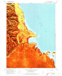
1968 Map of Plug Peak
USGS Topo · Published 1973About this map
Stansbury Island rises sharply from the eastern shores of the Great Salt Lake in this late 1960s study, revealing a landscape defined by the intersection of steep canyons and vast shoreline deposits. The western half of the quadrangle is dominated by the prominence of Plug Peak and a series of drainage systems including Ben Allen Canyon, Cane Canyon, and Shanty Canyon. These steep slopes give way to a wide Mud Flat to the east, illustrating the fluctuating lake levels and the specialized industry found in this environment. Economic activity is represented by the Salt Evaporators at the southern edge and a nearby Pumping Station, while isolated water sources like Cane Spring and Shanty Spring mark vital points on the island's arid terrain. A single Trail and a Gravel Pit suggest the limited but present human footprint in this corner of Tooele County.
Find a feature on this map
22 named features on this map. Tap any name to fly to it.
Don’t see what you’re looking for? This feature index may not catch every label — zoom into the map to look around manually.
Map Details
Editions of this 1968 Plug Peak Map
This is the sole edition of this map. No revisions or reprints were ever made.
Other maps of this area

1885 · Tooele Valley
USGS Topo · 1:250,000

1953 · Tooele
USGS Topo · 1:250,000

1955 · Timpie
USGS Topo · 1:62,500

1955 · Mills Junction
USGS Topo · 1:24,000

1955 · Burmester
USGS Topo · 1:24,000

1955 · Tooele
USGS Topo · 1:250,000

1968 · Plug Peak SE
USGS Topo · 1:24,000

1968 · Plug Peak NW
USGS Topo · 1:24,000

1968 · Badger Island
USGS Topo · 1:24,000

1968 · Corral Canyon
USGS Topo · 1:24,000