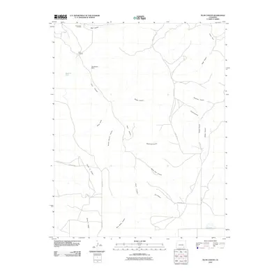
2010 Map of Plum Canyon
USGS Topo · Published 2010About this map
Courthouse Rock stands as a prominent landmark in this section of Las Animas County, overlooking a network of drainages that define the high plains landscape. The area is characterized by deep, episodic watercourses such as Plum Canyon and School Section Canyon, which carve through the terrain toward the south and east. Human activity is marked by essential water infrastructure for ranching, including the Reed Canyon Windmill and Plum Windmill, alongside scattered water catchment features like the Seven D Tank. The road network is sparse, consisting primarily of county routes such as County Rd 179 and County Rd 171, which navigate between the rimrock and canyon floors. Notable geographical features like Indian Trail Canyon and Deadman Canyon suggest a landscape shaped by historical passage and the naming conventions of early cattlemen and settlers in this southeastern Colorado territory.
Find a feature on this map
26 named features on this map. Tap any name to fly to it.
Don’t see what you’re looking for? This feature index may not catch every label — zoom into the map to look around manually.
Map Details
Editions of this 2010 Plum Canyon Map
This is the sole edition of this map. No revisions or reprints were ever made.
Other maps of this area

1891 · Higbee
USGS Topo · 1:125,000

1891 · Timpas
USGS Topo · 1:125,000

1891 · Mesa De Maya
USGS Topo · 1:125,000

1892 · Mt Carrizo
USGS Topo · 1:125,000

1893 · Higbee
USGS Topo · 1:125,000

1893 · Mesa de Maya
USGS Topo · 1:125,000

1894 · Timpas
USGS Topo · 1:125,000

1955 · La Junta
USGS Topo · 1:250,000

1958 · La Junta
USGS Topo · 1:250,000

1968 · La Junta
USGS Topo · 1:250,000