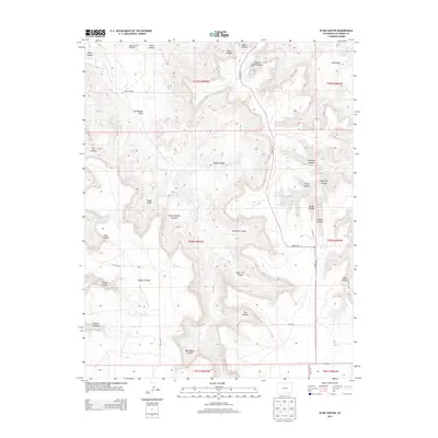
2013 Map of Plum Canyon
USGS Topo · Published 2013About this map
Courthouse Rock stands as a prominent landmark in this deeply dissected portion of Las Animas County, where the drainage of Plum Creek has carved an intricate network of canyons and draws. This 2013 landscape reflects a high-plains ranching environment defined by its water sources, featuring vital infrastructure like Reed Canyon Windmill, Plum Windmill, and the Seven D Tank. The map reveals a naming convention heavily influenced by the physical geography and local history, from the descriptive Stinking Hole Canyon and Deadman Canyon to the evocative Seven D Pocket. Transportation is limited to a sparse grid of county roads, including County Road 177.9 and County Road 179, which follow the more accessible terrain between the complex canyon systems of Briggs Canyon and Indian Trail Canyon.
Find a feature on this map
44 named features on this map. Tap any name to fly to it.
Don’t see what you’re looking for? This feature index may not catch every label — zoom into the map to look around manually.
Map Details
Editions of this 2013 Plum Canyon Map
This is the sole edition of this map. No revisions or reprints were ever made.
Other maps of this area

1891 · Higbee
USGS Topo · 1:125,000

1891 · Timpas
USGS Topo · 1:125,000

1891 · Mesa De Maya
USGS Topo · 1:125,000

1892 · Mt Carrizo
USGS Topo · 1:125,000

1893 · Higbee
USGS Topo · 1:125,000

1893 · Mesa de Maya
USGS Topo · 1:125,000

1894 · Timpas
USGS Topo · 1:125,000

1955 · La Junta
USGS Topo · 1:250,000

1958 · La Junta
USGS Topo · 1:250,000

1968 · La Junta
USGS Topo · 1:250,000