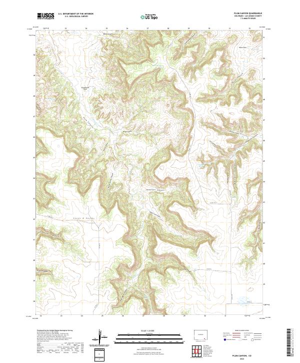
2022 Map of Plum Canyon
USGS Topo · Published 2022About this map
Plum Cr and its complex network of seasonal drainages define this portion of Las Animas County. The landscape is characterized by deeply incised topography, with major corridors such as Deadman Canyon and Indian Trail Canyon branching off from the main creek bed. Named landmarks like Courthouse Rock and the high ground of Piñon Park provide navigational references in an area otherwise dominated by winding draws and pockets, including the distinctly named Seven D Pocket.
Find a feature on this map
39 named features on this map. Tap any name to fly to it.
Don’t see what you’re looking for? This feature index may not catch every label — zoom into the map to look around manually.
Map Details
Editions of this 2022 Plum Canyon Map
This is the sole edition of this map. No revisions or reprints were ever made.
Other maps of this area

1891 · Higbee
USGS Topo · 1:125,000

1891 · Timpas
USGS Topo · 1:125,000

1891 · Mesa De Maya
USGS Topo · 1:125,000

1892 · Mt Carrizo
USGS Topo · 1:125,000

1893 · Higbee
USGS Topo · 1:125,000

1893 · Mesa de Maya
USGS Topo · 1:125,000

1894 · Timpas
USGS Topo · 1:125,000

1955 · La Junta
USGS Topo · 1:250,000

1958 · La Junta
USGS Topo · 1:250,000

1968 · La Junta
USGS Topo · 1:250,000