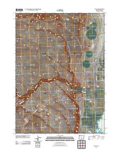
2011 Map of Plush
USGS Topo · Published 2011About this map
Plush serves as the small hub for this high-desert ranching community in southern Oregon, where the local Plush Post Office anchors a sparsely populated landscape of expansive ranch holdings. The map illustrates a distinctive settlement pattern defined by isolated homesteads such as Con Lynch Ranch, Flynn Ranch, and Taylor Ranch, all situated near the vital water sources that cut through the arid terrain. Natural drainages like Honey Creek, Twelvemile Creek, and Fish Creek flow toward the eastern edge of the quadrangle, where the shoreline of Hart Lake begins to emerge. This hydrological system is further defined by seasonal features like Juniper Spring Draw and Miners Draw, which emphasize the importance of water management in Lake County's agricultural history. The road network, including County Hwy 3-13 and Hogback Rd, highlights the connectivity between these remote outposts and the larger region.
Find a feature on this map
17 named features on this map. Tap any name to fly to it.
Don’t see what you’re looking for? This feature index may not catch every label — zoom into the map to look around manually.
Map Details
Editions of this 2011 Plush Map
This is the sole edition of this map. No revisions or reprints were ever made.
Other maps of this area

1955 · Klamath Falls
USGS Topo · 1:250,000

1955 · Adel
USGS Topo · 1:250,000

1957 · Adel
USGS Topo · 1:250,000

1958 · Klamath Falls
USGS Topo · 1:250,000

1958 · Adel
USGS Topo · 1:250,000

1962 · Adel
USGS Topo · 1:250,000

1967 · Flagstaff Lake
USGS Topo · 1:24,000

1967 · Plush
USGS Topo · 1:24,000

1967 · Rabbit Hills SW
USGS Topo · 1:24,000

1967 · Priday Reservoir
USGS Topo · 1:24,000