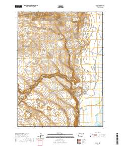
2020 Map of Plush
USGS Topo · Published 2020About this map
Plush is the primary settlement in this corner of the high desert, positioned at the edge of the expansive Warner Valley wetlands. The landscape is defined by the sharp descent of the western rim, where drainages like Juniper Spring Draw and Miners Draw cut through the volcanic tablelands. In the valley floor, the hydrology is dominated by Hart Lake and the meandering courses of Honey Creek and Twelvemile Creek. The transportation network is built around local hubs like the intersection of Plush Cutoff Rd and Hogback Rd, while Hart Mountain Rd provides access toward the massive fault-block ridge to the east. This map illustrates the vital connection between the desert rangelands and the seasonal water sources of the valley, a relationship that has dictated ranching and settlement patterns in Lake County for over a century.
Find a feature on this map
19 named features on this map. Tap any name to fly to it.
Don’t see what you’re looking for? This feature index may not catch every label — zoom into the map to look around manually.
Map Details
Editions of this 2020 Plush Map
This is the sole edition of this map. No revisions or reprints were ever made.
Other maps of this area

1955 · Klamath Falls
USGS Topo · 1:250,000

1955 · Adel
USGS Topo · 1:250,000

1957 · Adel
USGS Topo · 1:250,000

1958 · Klamath Falls
USGS Topo · 1:250,000

1958 · Adel
USGS Topo · 1:250,000

1962 · Adel
USGS Topo · 1:250,000

1967 · Flagstaff Lake
USGS Topo · 1:24,000

1967 · Plush
USGS Topo · 1:24,000

1967 · Rabbit Hills SW
USGS Topo · 1:24,000

1967 · Priday Reservoir
USGS Topo · 1:24,000