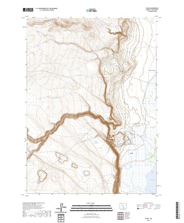
2024 Map of Plush
USGS Topo · Published 2024About this map
Plush sits at the eastern edge of the Warner Valley floor, positioned near where the foothills descend into a landscape of wetlands and lake beds. This 2024 survey captures the hydraulic relationship between the highland drainages and the valley floor, with Honey Creek and Twelvemile Creek feeding toward the expanse of Hart Lake. The topography is defined by the sharp transition from the elevated plateaus of t36s r24e down to the basin, marked by steep draws like Miners Draw and Juniper Spring Draw.
Find a feature on this map
18 named features on this map. Tap any name to fly to it.
Don’t see what you’re looking for? This feature index may not catch every label — zoom into the map to look around manually.
Map Details
Editions of this 2024 Plush Map
This is the sole edition of this map. No revisions or reprints were ever made.
Other maps of this area

1955 · Klamath Falls
USGS Topo · 1:250,000

1955 · Adel
USGS Topo · 1:250,000

1957 · Adel
USGS Topo · 1:250,000

1958 · Klamath Falls
USGS Topo · 1:250,000

1958 · Adel
USGS Topo · 1:250,000

1962 · Adel
USGS Topo · 1:250,000

1967 · Flagstaff Lake
USGS Topo · 1:24,000

1967 · Plush
USGS Topo · 1:24,000

1967 · Rabbit Hills SW
USGS Topo · 1:24,000

1967 · Priday Reservoir
USGS Topo · 1:24,000