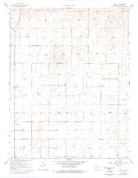
1960 Map of Plymell
USGS Topo · Published 1977About this map
Plymell is the central settlement in this portion of Kansas, appearing as a quiet crossroads amidst a landscape undergoing a technological transition during the mid-20th century. The terrain is notably marked by an extensive grid of extraction, with numerous Gas Wells scattered across the township boundaries of Garden City, Ivanhoe, and Pierceville. This distribution suggests a significant shift in land use, where traditional agricultural fields began to share space with energy infrastructure.
Find a feature on this map
7 named features on this map. Tap any name to fly to it.
Don’t see what you’re looking for? This feature index may not catch every label — zoom into the map to look around manually.
Map Details
Editions of this 1960 Plymell Map
2 editions found
Other maps of this area

1896 · Garden
USGS Topo · 1:125,000

1955 · Dodge City
USGS Topo · 1:250,000

1958 · Dodge City
USGS Topo · 1:250,000

1959 · Dodge City
USGS Topo · 1:250,000

1959 · Garden City 3 NW
USGS Topo · 1:24,000

1959 · Garden City 3 NE
USGS Topo · 1:24,000

1960 · Garden City East
USGS Topo · 1:24,000

1960 · Garden City SW
USGS Topo · 1:24,000
1960 · Garden City West
USGS Topo · 1:24,000

1960 · Plymell
USGS Topo · 1:24,000