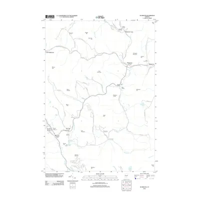
2012 Map of Plymouth
USGS Topo · Published 2012About this map
Plymouth Notch stands as a focal point of this Windsor County survey, preserving the rural character of a settlement famously tied to Vermont history. The landscape is defined by the narrow valleys of the Ottauquechee River and the Black River, where small clusters like West Bridgewater and Bridgewater Corners developed at key road junctions. Numerous burying grounds, including the Plymouth Notch Cem and the Plymouth-Five Corners Cem, are scattered across the terrain, reflecting the long-standing genealogical roots of the upland townships. To the south, the terrain rises toward East Mountain and Soltudus Mountain, while the Round Top Mountain Ski Area marks the intersection of traditional land use and modern recreation. The map meticulously traces the network of backroads such as Sawmill Rd and Hale Hollow Rd that connect isolated clearings and historic homesteads.
Find a feature on this map
89 named features on this map. Tap any name to fly to it.
Don’t see what you’re looking for? This feature index may not catch every label — zoom into the map to look around manually.
Map Details
Editions of this 2012 Plymouth Map
This is the sole edition of this map. No revisions or reprints were ever made.
Other maps of this area

1891 · Rutland
USGS Topo · 1:62,500

1893 · Wallingford
USGS Topo · 1:62,500

1893 · Rutland
USGS Topo · 1:62,500

1911 · Woodstock
USGS Topo · 1:62,500

1913 · Woodstock
USGS Topo · 1:62,500

1928 · Ludlow
USGS Topo · 1:48,000

1929 · Ludlow
USGS Topo · 1:62,500

1932 · Ludlow
USGS Topo · 1:62,500

1943 · Woodstock
USGS Topo · 1:62,500

1950 · Glens Falls
USGS Topo · 1:250,000