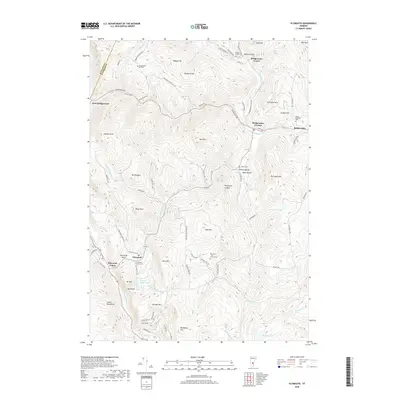
2018 Map of Plymouth
USGS Topo · Published 2018About this map
Plymouth Notch and the neighboring village of Plymouth Union serve as the focal points for this study of Vermont's mountainous terrain along the Black River. The landscape is defined by the steep slopes of the Green Mountains, with numerous family and community landmarks such as Bridgewater Hill Cem and Topliff Cem marking the historic settlements. The map illustrates a network of hollows, including Pinney Hollow and Hale Hollow, where small communities developed along watercourses like Pinney Hollow Brook and Broad Brook.
Find a feature on this map
89 named features on this map. Tap any name to fly to it.
Don’t see what you’re looking for? This feature index may not catch every label — zoom into the map to look around manually.
Map Details
Editions of this 2018 Plymouth Map
This is the sole edition of this map. No revisions or reprints were ever made.
Other maps of this area

1891 · Rutland
USGS Topo · 1:62,500

1893 · Wallingford
USGS Topo · 1:62,500

1893 · Rutland
USGS Topo · 1:62,500

1911 · Woodstock
USGS Topo · 1:62,500

1913 · Woodstock
USGS Topo · 1:62,500

1928 · Ludlow
USGS Topo · 1:48,000

1929 · Ludlow
USGS Topo · 1:62,500

1932 · Ludlow
USGS Topo · 1:62,500

1943 · Woodstock
USGS Topo · 1:62,500

1950 · Glens Falls
USGS Topo · 1:250,000